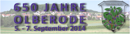
The 650th Year Celebration of Olberode, where
many of our Goetz and Webert ancestors came from!
The following is from the official website -
check for updates at http://www.650-jahre-olberode.de/
Welcome to the online presence of the 650-year
celebration of Olberode.
The site is still under construction, but we are all striving hard to
provide relevant information on a timely manner.
Brief
History
of Olberode
Olberode, on the southeast slope of the Goat
Mountain, is 420-450 meters high, which makes it the highest village in the
municipality of Upper Hall.
The village lies on the main road and Highway 454
on the former railway line, now Red Riding Hood Bike Path, going from the towns
of Treysa to Bad Hersfeld.
Naming
of Olberode:
People already lived here 3500 years ago, which is
proven by the flint dagger found here, called the "Olberöder splendor
Dagger." It was only in 1364 that our village was first mentioned. The
legend tells of the four brothers Adolf, Christian, Friedrich, and Eckhart who
cleared the forest and founded the villages of Olberode, Christerode,
Friedigerode and Eckenrode. The name Olberode changed from Adolfsrode,
Udolfsrode, Olffenrode (1574), Olbenrode (1595), Olbenroth (1700), T PISTON
Roth (1715), Olfenrode (1746), Olberode (1800), Top Roth, Olberoth (1865) and
finally Olberode .
The
Village Church:
In the center of the village is the church. The
independent parish, with headquarters in Olberode was assigned in 2010 to be
the center for the villages of Christerode, Hauptschwenda and Weissenborn.
Since the January 1, 2011 restructuring of the Evangelical Church of Hesse
Electorate-Waldeck, the parish consists of the villages Olberode, Weissenborn,
and Schorbach Asterode. The headquarters of the rectory is in Olberode, and was
inaugurated on November 28, 1953 and extensively renovated in 1998.
Schools:
Since July 2, 1700 there was a school in Olberode.
In 1857 an old school, which previously served as a home, was purchased for
1355 coins. It is House 21. Previously, the teacher taught in "Lisses old
house" (house number 42), and later in number 38, a farmhouse (which is
today the Bernard barn) In number 38 the teacher taught in a room that served
as living, sleeping, and working space at the same time for him.
Mills:
According to old records, there were in and around
Olberode also several mills: Fickel was a mill, the house with the number 1,
and two other mills were at the nearby village of Schorbach - on today's Black
Börner Road, and at the auditorium - heading towards Hollenbach.
Roads:
In 1957, the military training area, Schwarzenborn,
was put into operation. All the troops' travel, some with heavy equipment, was
from the top station to Schwarzenborn auditorium, by Olberode. The heavy burden
of the travel and severe damage to the main road led to the decision to
construct a bypass road (road armor). In 1967 the course of the 3161 national
road was changed and passed by the junction of highway 454 through the field at
the local district location of Olberode.
On November 18, 1956 it was
dedicated to be a war memorial at a cemetery.
Volunteer
Fire Department and Water Supply:
A volunteer fire department was founded in 1934,
and in 1954 a fire station was built in the "Firehouse on Winning." A
dam was built on Schorbach Creek with pipes supplying enough non-potable water
for fire extinguishing.
New water mains were laid in 1962. After 1963 a
new, elevated water tank was built. In 1965-1966 a new water reservoir was
created by means of a deep hole approximately 100 meters deep.
In 1970 there was a consolidation
process between the village of Olberode and the larger town of Oberaula. The
land consolidation area covered 1660 acres and involved 154 property owners.
In 1972 a new portable vehicle
pump (model TSF) was given to the local fire department. Because of extensive corrosion damage
over the years it was replaced in 1972 by a new portable fire pump containing a
137 gallon water tank, model TSF-W. A new fire station was built in 1985 at
Goat Mountain right next to the teacher's home of the "new school",
but which was used as a community center since 1970.
Street
Names:
On January 1, 1974 Olberode lost its independence
and became incorporated into the Upper Town Hall. Since the merger of several
places for the community of Oberaula some street names were changed, and many
streets were not named. In 1977 the local streets were given new names. Up to
this time there was only the old house counting method for the old village.
Some new homes were built. So you can still detect how old a house is, but not
at which location it was in the village.
In1982 Olberode became an
"accredited resort".
Olberode
Today:
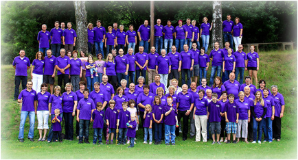
Olberode today has about 400 inhabitants who are
active in numerous clubs. They work together to ensure an exciting and
hospitable village for both its residents and also vacationers.
650th
Anniversary Program:
The dates of the celebration are September 5-7,
2014. The program is not completely finalized yet, but will include:
Friday, September 5: a celebration in the marquee.
Saturday, September 6: a daytime reunion followed
by a program starting at 8 PM.
Sunday, September 7: pageant.
The web site, http://www.650-jahre-olberode.de/
will be updated as we have more details about the program.
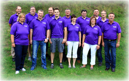
Festival
Committee:
The festival committee consists of 14 members. Each
local association is represented by a member of the Committee.